• Skip to main content
  • Skip to header right navigation
  • Skip to after header navigation
  • Skip to site footer
MyZA

MyZA

News, Directory, Events and Other Stuff

  • Social Media
  • Sport
  • World News
  • Home
  • Submit News
  • Directory
  • Events
  • Stratlec
  • TFSA
  • News
    • APO
    • Today’s Sport News
    • Todays Social Media and Tech Headlines
    • Today’s World News
    • Today’s SA Financial News
  • Contact
You are here: Home / News / Cooler weekend expected, says weather service

Cooler weekend expected, says weather service

18 September 2024 by Guest

Cooler weekend expected, says weather service

While many South Africans are experiencing a hot to very hot start to spring with the first heat wave of the season occurring over parts of Mpumalanga and Limpopo, cooler weather is expected from Thursday.

Weather conditions are expected to change significantly as a cold front and cut-off low-pressure system will introduce wintery conditions to the Western Cape, southern parts of the Northern Cape and the Eastern Cape from Thursday, 19 September 2024. 

Significantly colder conditions will then spread to KwaZulu-Natal, the Free State and Mpumalanga on Friday, 20 September, and reach Gauteng, North West and Limpopo on Saturday, 21 September.

“Disruptive snowfall and bitterly cold conditions are expected to affect the high-lying areas of the Eastern Cape (especially the north-eastern high-ground) from Thursday, spreading to the eastern and southern high-ground of the Free State, the western and southern high-ground of KwaZulu-Natal and extending as far as the southern Highveld of Mpumalanga on Friday into Saturday morning,” the SA Weather Service (SAWS) said in a statement. 

The public and small stock farmers are advised to take the necessary precautions ahead of the expected adverse weather conditions to ensure the safety and health of their animals.

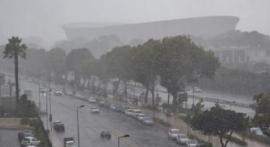
A cold front arrives in the Western Cape today resulting in showers and rain over the south-western parts, spreading to the Garden Route and Little Karoo by this evening and to the Eastern Cape tomorrow. 

“It will be cold to very cold over parts of the Western Cape interior and the Eastern Cape on Thursday. Strong to near-gale force winds with rough seas of 4 to 6 metres are likely along the Western Cape coast today, spreading to parts of the Eastern Cape coast overnight and to the coast of KwaZulu-Natal tomorrow.  

“Light snowfalls are likely to occur over the eastern mountains of the Western Cape and the northern high-ground and mountains of the Eastern Cape, mainly from Thursday afternoon into the evening, while becoming disruptive over the north-eastern high ground of the Eastern Cape later in the evening,” the Weather Service said.

In contrast, very hot to extremely hot temperatures – exceeding 38 to 40°C – are expected to occur over parts of the Limpopo Valley and Lowveld of Limpopo ahead of this system.

On Friday, an intense cut-off low pressure system will develop along the border of the Northern and Eastern Cape provinces and will move into the southern parts of the Free State in the evening.

This system will result in widespread showers and thundershowers over parts of the Eastern Cape and KwaZulu-Natal (with possible heavy rainfall along the coastal regions), while scattered thunderstorms are possible over parts of Gauteng, western Limpopo, the eastern parts of the North West and the Free State as well as parts of Mpumalanga. 

Bitterly cold daytime temperatures of 4 to 8°C can be expected over the high-lying areas of the Eastern Cape, the eastern Free State, and the interior of KwaZulu-Natal, where widespread snowfall is likely. 

SAWS said current numerical weather prediction models indicate the possibility of light snowfall over the southern parts of Gauteng and the remainder of the Highveld of Mpumalanga on Saturday morning. 

“However, there is significant uncertainty regarding this outlook, as the forecast may still change.”

Disruptive snowfall of 15 to 30 cm can be expected over the north-eastern high-lying areas of the Eastern Cape, the western and southern areas of KwaZulu-Natal, the eastern Free State and the southern Highveld and escarpment of Mpumalanga, mainly on Friday continuing into Saturday morning. 

“This may result in the closure of mountain passes, loss of livestock and crops, and affect major traffic routes (parts of the N3, N5 and N11). Cold to very cold daytime temperatures (8 to 12°C) can also be expected over Gauteng and the eastern parts of North West on Saturday, 21 September. 

The cut-off low is expected to weaken and exit the country from Saturday afternoon. Daytime temperatures are expected to recover quickly from Sunday into Monday across eastern South Africa. 

The weather service will therefore continue to monitor any further developments relating to this weather system and will issue subsequent updates as required. 

The public is urged and encouraged to regularly follow weather forecasts on television and radio. – SAnews.gov.za

Edwin
Wed, 09/18/2024 – 14:58

651 views

While many South Africans are experiencing a hot to very hot start to spring with the first heat wave of the season occurring over parts of Mpumalanga and Limpopo, cooler weather is expected from Thursday.

Weather conditions are expected to change significantly as a cold front and cut-off low-pressure system will introduce wintery conditions to the Western Cape, southern parts of the Northern Cape and the Eastern Cape from Thursday, 19 September 2024. 

Significantly colder conditions will then spread to KwaZulu-Natal, the Free State and Mpumalanga on Friday, 20 September, and reach Gauteng, North West and Limpopo on Saturday, 21 September.

“Disruptive snowfall and bitterly cold conditions are expected to affect the high-lying areas of the Eastern Cape (especially the north-eastern high-ground) from Thursday, spreading to the eastern and southern high-ground of the Free State, the western and southern high-ground of KwaZulu-Natal and extending as far as the southern Highveld of Mpumalanga on Friday into Saturday morning,” the SA Weather Service (SAWS) said in a statement. 

The public and small stock farmers are advised to take the necessary precautions ahead of the expected adverse weather conditions to ensure the safety and health of their animals.

A cold front arrives in the Western Cape today resulting in showers and rain over the south-western parts, spreading to the Garden Route and Little Karoo by this evening and to the Eastern Cape tomorrow. 

“It will be cold to very cold over parts of the Western Cape interior and the Eastern Cape on Thursday. Strong to near-gale force winds with rough seas of 4 to 6 metres are likely along the Western Cape coast today, spreading to parts of the Eastern Cape coast overnight and to the coast of KwaZulu-Natal tomorrow.  

“Light snowfalls are likely to occur over the eastern mountains of the Western Cape and the northern high-ground and mountains of the Eastern Cape, mainly from Thursday afternoon into the evening, while becoming disruptive over the north-eastern high ground of the Eastern Cape later in the evening,” the Weather Service said.

In contrast, very hot to extremely hot temperatures – exceeding 38 to 40°C – are expected to occur over parts of the Limpopo Valley and Lowveld of Limpopo ahead of this system.

On Friday, an intense cut-off low pressure system will develop along the border of the Northern and Eastern Cape provinces and will move into the southern parts of the Free State in the evening.

This system will result in widespread showers and thundershowers over parts of the Eastern Cape and KwaZulu-Natal (with possible heavy rainfall along the coastal regions), while scattered thunderstorms are possible over parts of Gauteng, western Limpopo, the eastern parts of the North West and the Free State as well as parts of Mpumalanga. 

Bitterly cold daytime temperatures of 4 to 8°C can be expected over the high-lying areas of the Eastern Cape, the eastern Free State, and the interior of KwaZulu-Natal, where widespread snowfall is likely. 

SAWS said current numerical weather prediction models indicate the possibility of light snowfall over the southern parts of Gauteng and the remainder of the Highveld of Mpumalanga on Saturday morning. 

“However, there is significant uncertainty regarding this outlook, as the forecast may still change.”

Disruptive snowfall of 15 to 30 cm can be expected over the north-eastern high-lying areas of the Eastern Cape, the western and southern areas of KwaZulu-Natal, the eastern Free State and the southern Highveld and escarpment of Mpumalanga, mainly on Friday continuing into Saturday morning. 

“This may result in the closure of mountain passes, loss of livestock and crops, and affect major traffic routes (parts of the N3, N5 and N11). Cold to very cold daytime temperatures (8 to 12°C) can also be expected over Gauteng and the eastern parts of North West on Saturday, 21 September. 

The cut-off low is expected to weaken and exit the country from Saturday afternoon. Daytime temperatures are expected to recover quickly from Sunday into Monday across eastern South Africa. 

The weather service will therefore continue to monitor any further developments relating to this weather system and will issue subsequent updates as required. 

The public is urged and encouraged to regularly follow weather forecasts on television and radio. – SAnews.gov.za


Watch a Cooler weekend expected, says weather service related video:

Stunning South Africa:

https://upnorthlive.com/resources/media2/16×9/1920/986/center/90/8e7504a9-2480-497f-bace-347a0230d54a-MacBridge_image4_medium4.jpg

Have you visited MyPR?

MyPR.co.za offers free to publish press releases for your news site, blog or offline publication. Use the handy REPUBLISH facility or the Full Text RSS Feeds or just copy and paste.

Straton Electrical | Straton Solar | Straton Prepaid | Straton Plumbing | Straton IoT | Straton eBikes | BA Systems | Mbane Contracting | Reach Trust

Share this:

  • Share on X (Opens in new window) X
  • Share on Facebook (Opens in new window) Facebook
  • Print (Opens in new window) Print
  • Email a link to a friend (Opens in new window) Email
  • Share on LinkedIn (Opens in new window) LinkedIn
  • Share on Tumblr (Opens in new window) Tumblr
  • Share on WhatsApp (Opens in new window) WhatsApp
  • Share on Mastodon (Opens in new window) Mastodon
Category: NewsTag: 2024, Africa, Eastern Cape, Free State, health, KwaZulu-Natal, Limpopo, Mpumalanga, North West, SA News, South Africa, Video, Western Cape

If you feel strongly about this article then feel free to send MyZA a ‘Letter to the Editor’ using the submission form below:


Letter to the Editor

This field is for validation purposes and should be left unchanged.
If this is in response to an article please include that article title here or as the lead in for the first paragraph of your Letter below.

Separate tags with commas

Localise your letter by naming the city your words are about. Add relevant words describing your subject. Single comma separated words of no more than 5
Your Name(Required)
Your Name will be linked to the website below.
Your personal, business or social media web site
Choose NO to not set up a user account on MyZA. User Accounts will allow you to submit letters under your own Author Name

3 Latest Letters to the Editor:

  • NSFAS 2027 applications close on 31 October — SASSA households, apply now

    Dear Editor, I run SAGrant (sagrant.co.za), a free resource helping South Africans navigate SASSA grants. NSFAS applications for the 2027 academic year close on Friday 31 October 2026, and no extension is expected. If your household receives a SASSA grant, your child already passes the NSFAS financial eligibility test — but they still have to…

    25 October 2026
  • Publish the Call, Then Publish the Grade

    Dear Editor, South African football fans argue about everything — lineups, referees, who should start up front. But there’s one argument we never have, because nobody gives us the numbers: were the predictions we read all week actually any good? I help run XG Mind AI, a small independent football data lab. Our rule is…

    25 October 2026
  • Don’t Ignore a SASSA Review Notice — It Is Not a Cancellation

    Dear Editor, I run SAGrant (sagrant.co.za), a free resource helping South Africans navigate SASSA grants. SASSA has reminded beneficiaries that a grant review is not a cancellation. A review simply checks whether a beneficiary still meets the qualifying requirements — it can be triggered by a change in income, employment, marital status, address, contact details…

    19 October 2026

About Guest

Previous Post:Lindile Safaris Launches Brand New Website
Next Post:Impalas Ready To Defend Their Title In The T20 Knockout

Reader Interactions

Comments

  1. Thumb Candy

    6 September 2026 at 4:14 pm

    Fun South African Fact: South Africa has hosted the football (2010), cricket (2003) and rugby (1995) world cups

  2. Mafia Rapunzel

    2 September 2026 at 9:45 pm

    Alaska: You have two cows. Their combined IQ is higher than that of your most popular governor.

Copyright © 2026 · MyZA · All Rights Reserved · Powered by Stratlec Online